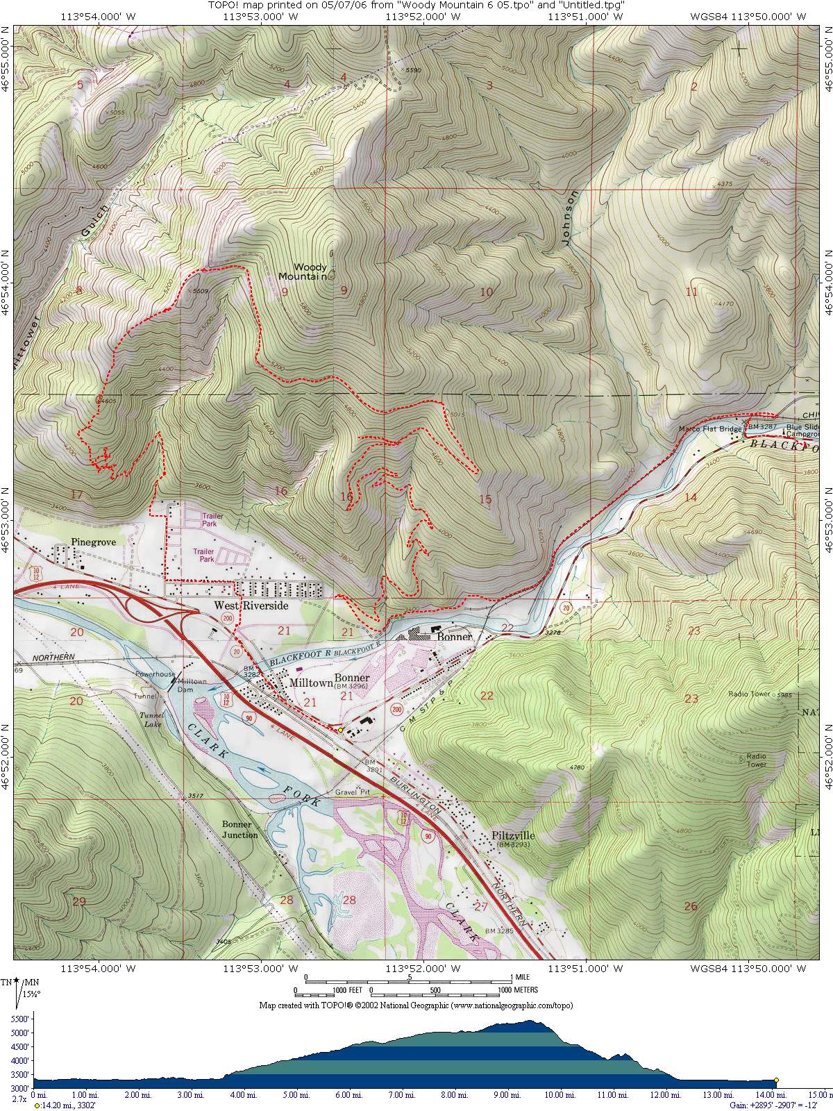
Woody Mountain Trail
Starting Location: Start this ride by parking in a pullout across from the Bonner Truck stop on Hiway 200, then shuttle to the Marco Flats fishing access on the Blackfoot River, which is on the left side of the road about 3 miles northwest of Bonner on Hiway 200. After leaving the parking area, travel back a few hundred yards southeast on Hiway 200 to a road on the east side of the Blackfoot tavern that leads to the Marco Flats swinging footbridge. Once on the north side of the Blackfoot river travel southeast about 3 miles until overlooking Milltown, then turn north on a logging road that leads up the mountain. After traveling about 9 miles from the footbridge look for a singletrack trail on the left side of the road. Follow this trail down the ridge and into a drainage that exits at the bottom of the mountain into a trailer park. Proceed west along the streets back to the parking pullout across from the Bonner Truck stop.
Distance: 14.2 miles
Cumulative Elevation Gain: 2,895 feet
Moving Time: About 2 hours
Type of Trail: logging roads to the top, then single track down
Climb Difficulty (scale 1 to 6): 4.1