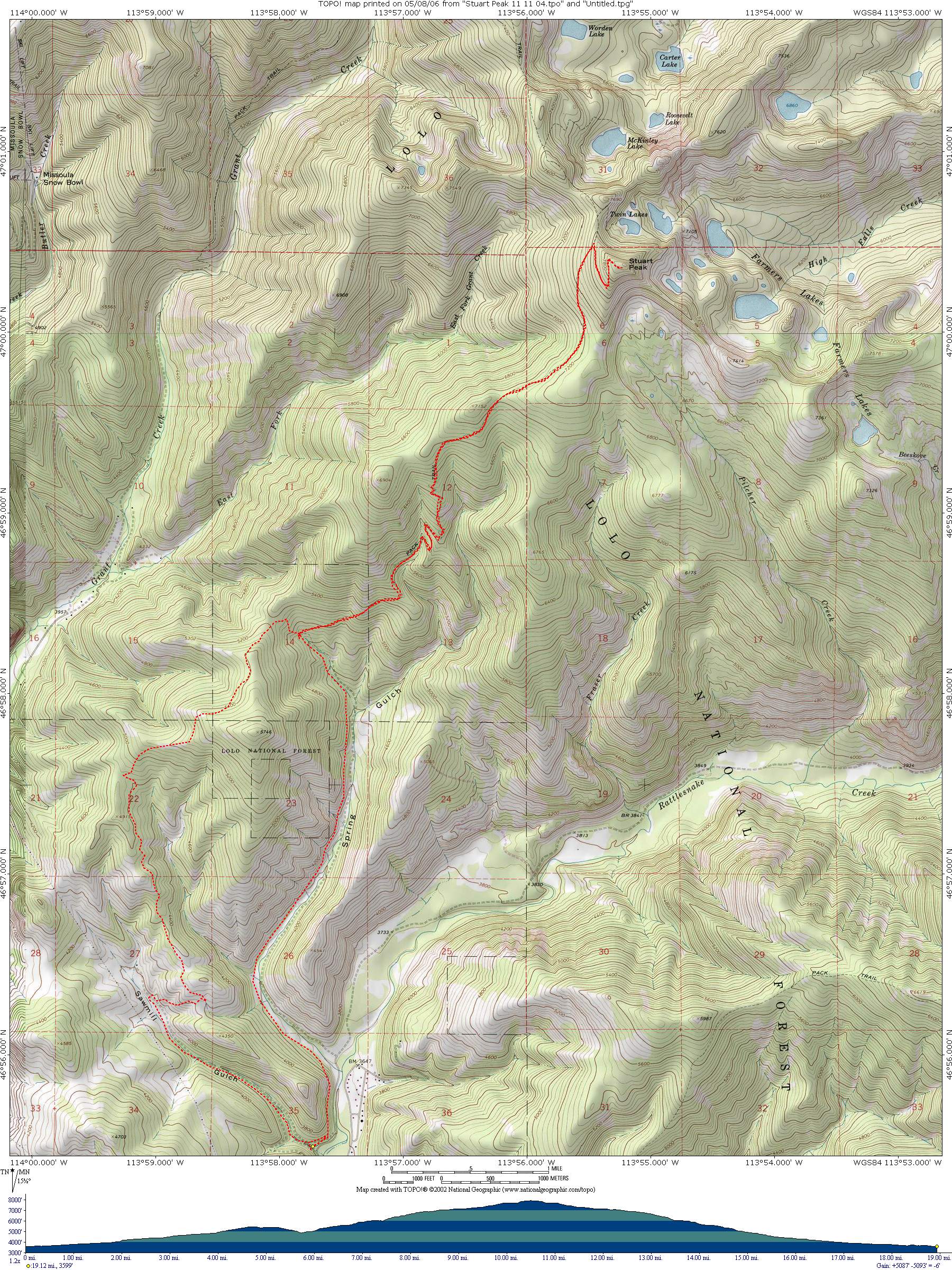
Stuart Peak Trail
Starting Location: Start at the Rattlesnake Recreation Area trailhead. Ride up the singletrack just to the north of the Sawmill Gulch Road. The singletrack will come out on the road just before the gate. Ride up about half a mile and take the trail to the right which climbs steeply to the top of the ridge. When you get to the top of the ridge, follow the ridge for a short distance and then take the trail to the left. The trail is level and then climbs to the ridge between Sawmill and Grant Creeks. Go right, and follow the signs to Stuart Peak. You will pass a junction with a trail coming up Curry Gulch and another junction with the Ravine Trail coming up from Grant Creek. Stop and look at the view at Snowbowl Overlook. The trail then drops into Spring Gulch and joins the Spring Gulch trail. At this junction, go left. There is 4-5 mile climb to the Wilderness Boundary which is clearly marked with signs. Bicycles are illegal in the Wilderness, so stash your bikes, and hike up the trail for a mile to a mile and a half, and then leave the trail on the right and climb to the top of Stuart Peak. On the way down, it is easier to go out the Spring Gulch trail.
Distance: 19 miles (including approximately 4 miles on foot)
Cumulative Elevation Gain: about 4000 feet on bicycle, 1000 feet on foot
Moving Time: about 4 to 5 hours
Type of Trail: single track
Bicycle Climb Difficulty (scale 1 to 6): 4.5 ft/mile x 100