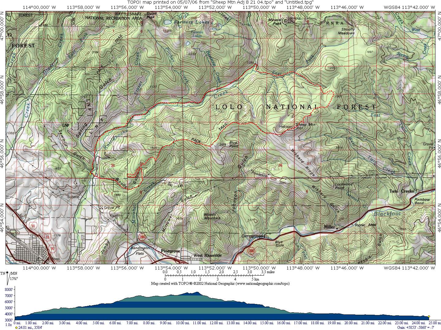
Sheep Mountain Trail
Starting Location: Start at the Rattlesnake Recreation Area trailhead. Proceed up Woods Gulch to Blue Point trail, then to the top of Sheep Mountain. (The map shows following some logging roads part way up. The trail has been rerouted to be easier to ride up, and the logging roads may be removed, so we suggest that you follow the trail. This would reduce the distance by a mile or so.) Return down the East Fork of Rattlesnake Creek, south of Mineral Peak, to the Rattlesnake corridor road, and then back to the trailhead.
Distance: 24.8 miles
Cumulative Elevation Gain: 5853 feet
Moving Time: about 5 to 6 hours
Type of Trail: single track, dirt road
Climb Difficulty (scale 1 to 6): 4.7 ft/mile x 100