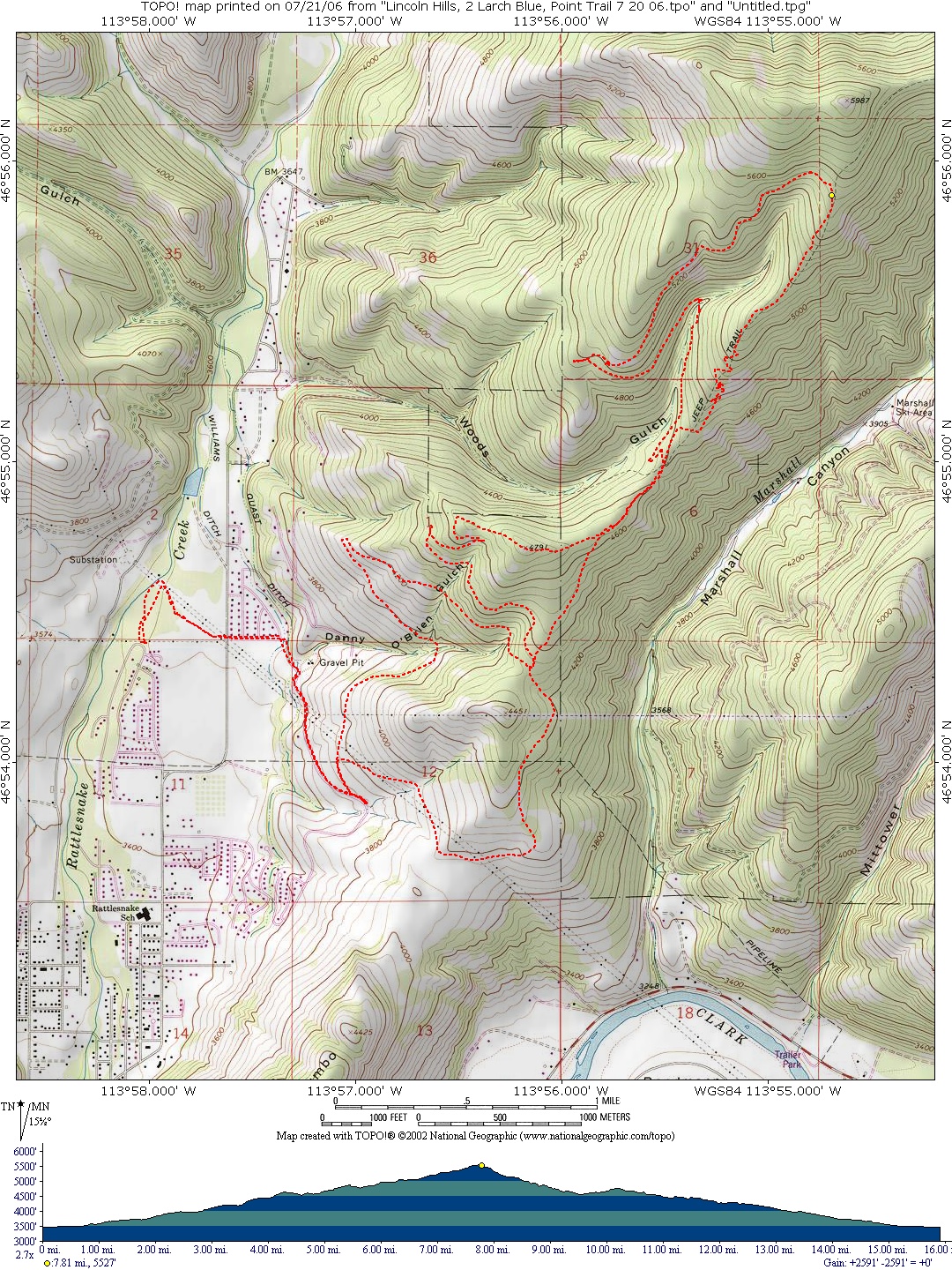
Lincoln Wood, Lincoln Hills, Two Larch, Blue Point Trail
Starting Location: This is a loop that starts at the Lincoln Wood Trailhead. Enter the trail and head north along Rattlesnake Creek, after about a quarter of a mile cross a foot bridge over a small stream flowing into Rattlesnake Creek, then turn right on a trail heading southeast. Cross over Rattlesnake Road to Tamarack Street, proceed east to the end of the road and enter onto a trail that heads up to the Lincoln Hills trailhead parking area. Turn left on the trailhead, after about a quarter of a mile turn right along the power line trail. Follow this dirt road as it winds around north and up to an intersection with a logging road. Turn right and take the Horse trail, which is the first trail to the right and follow it up the ridge. Proceed past the first left, which is the Sidewinder trail, and take the next trail to the left. Follow this trail as it intersects with the Wood’s Gulch trail as it enters onto the Two Larch Trail. Turn right and head up Two Larch until it intersects with the logging road from Marshall Canyon. Turn left on the logging road and proceed up the mountain around Wood’s Gulch to the left. After about 1 mile, turn right onto another logging road and follow it up the mountain to where it ends. Enter onto a single track trail through the woods, and then turn right as it enters onto the Blue Point trail. Shoot down this stretch of trail until it enters back onto the logging road from Marshall Canyon. The trail picks up again on the other side of the road and intersects back onto the horse trail. Turn right onto the Sidewinder trail. Follow this trail up and over the crest and down as it traverses onto a double track trail. Follow this trail until it enters onto the logging road that was crossed on the way up prior to entering the horse trail. Follow this winding road all the way back to the top of Lincoln Hills and to Lincoln Wood.
Note: Larry Dent started from and returned to the Lincoln Wood trailhead, and this is what the map shows. The rest of the group started and ended at the Lincoln Hills trailhead.
Distance: 16 miles
Cumulative Elevation Gain: 2385 feet
Moving Time: about 2 hours
Type of Trail: single track, double track, dirt roads, logging roads
Climb Difficulty (scale 1 to 6): 3.0 ft/mile x 100