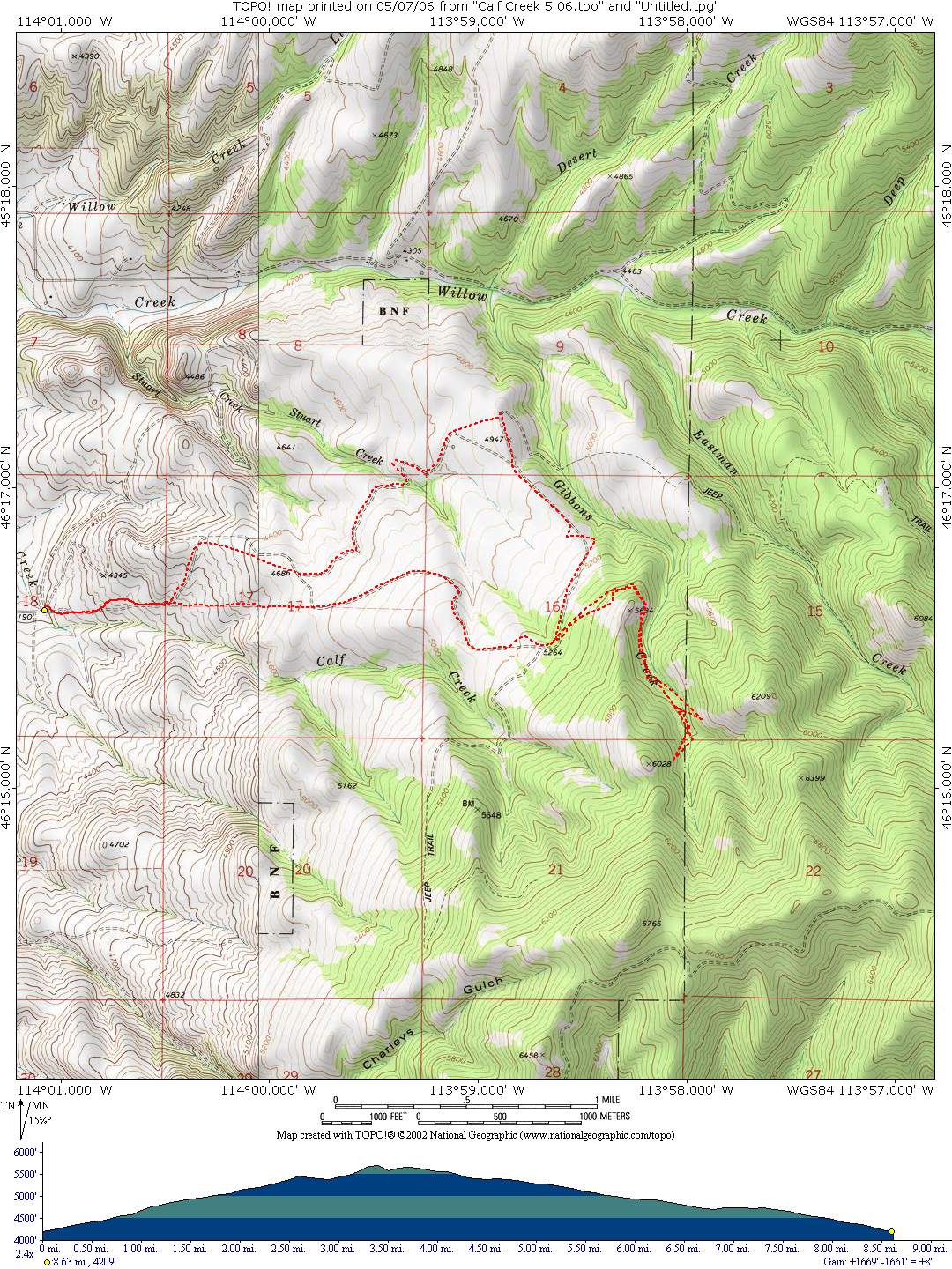
Calf Creek Trail
Starting Location: The trailhead is located 8 miles east of Hamilton in the Calf Creek Wildlife Management Area. From Missoula, take US Highway 93 south about 40 miles to the Corvallis turnoff. Turn east onto Route 373 and drive 2 miles to the town of Corvallis. Turn right (south) onto the East Side Highway then east on Hamilton Heights Road. Drive to the end of Hamilton Heights Road to WMA.
Distance: 8.62 miles
Cumulative Elevation Gain: 1642 feet
Moving Time: about 1.5 hours
Type of Trail: single track, some dirt roads
Climb Difficulty (scale 1 to 6): 3.9 ft/mile x 100