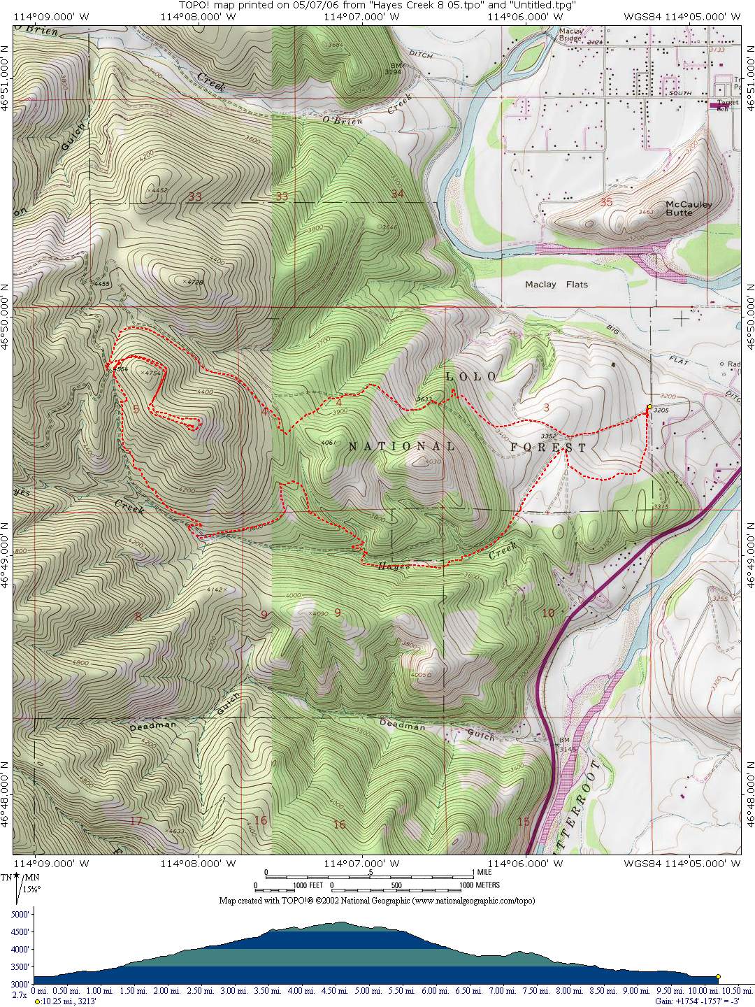
Blue Mountain Hayes Point Trail
Starting Location: This trail is a loop that starts at the Blue Mountain Recreation Area Trailhead. Follow the logging road west out of the parking lot; turn right at the 1st fork, then left on the 1st singletrack. The singletrack accesses a logging road that leads to the Blue Mountain road. After about ½ mile, look for a singletrack on the left side of the road. Follow this trail to the Hayes Point pullout, then follow the logging road to the top. Return on the logging road, once at the Hayes Point pullout; take the trail south, which leads to several miles of singletrack along Hayes Creek. Cross the foot bridge, then take the trail which leads to a gravel road. After about ½ mile, turn left on a singletrack that leads across the bench back to the trailhead.
Distance: 10.25 miles
Cumulative Elevation Gain: 1,754 feet
Moving Time: About 1.5 hours
Type of Trail: Logging roads, singletrack, and gravel roads
Climb Difficulty (scale 1 to 6): 3.4
Additional information: The trail after crossing the footbridge to the gravel road is on private property. At some point the owner may restrict access, if privilege is abused. An alternative route is to not cross the footbridge, but to head west along Hayes Creek until the trail accesses the gravel road.